


This thread is for discussions about the campaign map.
Here are some samples of the achievements so far:
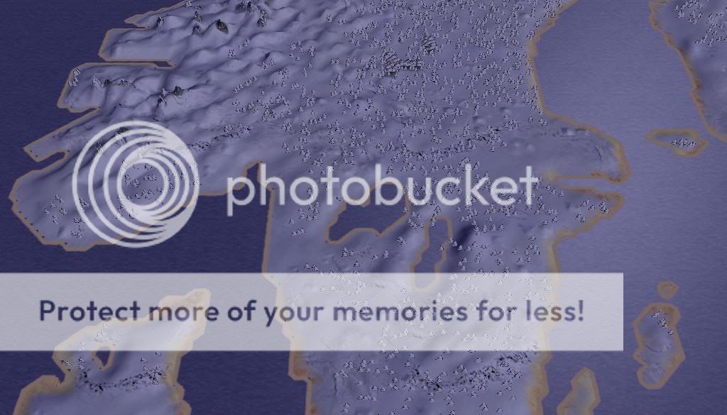
======================================
Example of campaign map - Scandinavia in winter time:
Known issues:
- provinces, cities, rivers, heights etc. aren't ready yet, this is just a very early alpha version of the map
- mini map - not all of the map is displayed on the minimap. This is being solved ATM.
Loading screens:
=============
--- Temporarily removed ---
Province list:
==========
1 - Aquitaine - Limoges
2 - Gascogne - Bordeaux
3 - Brittany - Rennes
4 - Neustria/Maine/Anjou - Orléans (could be replaced by Le Mans or Angers)
5 - Septimania - Montpellier (could be replaced by Narbonnes)
6 - Provence - Marseilles
7 - Burgundy - Besancon
8 - France - Paris
9 - Flanders - Boulogne
10 - Upper Normandy - Rouen
11 - Lower Normandy - Avranches
12 - Spanish March - Barcelona
13 - Navarre - Pamplona
14 - Castilla - Burgos
15 - Leon - Oviedo (could be remplaced by Leon -the city)
16 - Gallicia - Oporto (could be replaced by Santiago de Compostela)
17 - Toulouse - Toulouse
18 - Badajoz - Badajoz
19 - Toledo - Toledo
20 - Zaragoza - Zaragoza
21 - Valencia - Valencia (I don't know if this place was an independant Emirate or part of Cordoba during the 9th century)
22 - Almeria - Almeria
23 - Granada - Granada
24 - Cordova - Cordova
25 - Sevilla - Sevilla
26 - Novgorod - Novgorod
27 - Polotsk - Polotsk
28 - Smolensk - Smolensk
29 - Rostov-Suzdal - Rostov (could be replaced be either Vladimir or Suzdal)
30 - Kiev - Kiev
31 - Pereiaslav - Pereiaslav
32 - Chernihiv - Ryazan
33 - Volhynia - Brest
34 - Galich - Galich
35 - Estonia ? - ???
36 - Livonia ? - ???
37 - Lithuania - ???
38 - Prussia - ???
39 - Pomerania - Kolberg
40 - Mazovia - Plock
41 - Chrobatia - Cracow
42 - Polania - Posen
43 - Friesland - Utrecht
44 - Ripuaria (could be Upper Lorraine/Lotharingia) - Aix la Chapelle
45 - Moselle (could be Lower Lorraine/Lotharingia) - Strasburg
46 - Liguria - Genoa
47 - Tuscany - Florence (Pisa ?)
48 - States of the Church - Roma
49 - Spoleto - Spoleto
50 - Venetia - Venice
51 - Friuli - Aquileia
52 - Croatia - Sissek
53 - Servia - ???
54 - Lombardy - Milan
55 - Alemannia - Zurich
56 - Franconia - Frankfort
57 - Saxonnia - Bremen
58 - Transalbingia - Hamburg
59 - March of the Billungs - Oldenburg
60 - NordMark - Brandenburg
61 - OstMark - Juterbog
62 - Bohemia - Prague
63 - Bavaria - Salzburg
64 - Moravia - Olmutz
65 - Silesia - Breslau
66 - Carinthia - Fiesach
67 - Cherson - Cherson
68 - Tmoutarakan - Tmoutarakan
69 - Levédia - ??? (land of the Magyars in 840/850)
70 - Etelköz - ??? (land of the Magyars in 840/850)
71 - Pannonia - Ofen
72 - Avarorum Solitudo - Kaliesa (sp?)
73 - Carpathia - Erlau
74 - Transylvania - ???
75 - Banat - Vidin
76 - Dalmatia - Ragusa
77 - Dyrrachium - Dyrrachium
78 - Nicopolis - Nicopolis
79 - Peloponnesus - Corinthes
80 - Hellas - Athens
81 - Thessalonica - Salonica
82 - Macedonia - Andrianople
83 - Thrace - Constantinople
======================
Suggested additions/edits to list above:
Lithuania - Daugava
Estonia -> Revala - Revala (location same as modern Tallinn)
Prussia - Truso (lies just east of modern Gdansk)
Tuscany - I favor Pisa over Florence in this time period
Add: Mistra - Mistra on southern Pelopponessus, should be a Byzantine-owned small town
NORWAY AREA
* Hordaland - Bergen (town) (rebels)
* Hafrsfjord (rebels) - Nord-Jaeren / Stafangr
* Vaestfold - Kaupang (position close to Oslo but further down the fiord)
* Trondelag - Trondheim (town)
* Hologaland (modern Lofots area and mainland next to it) - Narvik
* Northern Norway - Tromso
* Finnmark - Kirkenes (situated next to Barents Sea and modern Russian border)
DENMARK AREA
* Sjaelland - Roskilde
* Holseta Land (modern Nordfriesland, in modern Schleswig-Holstein area) - Haithabu / Hedeby
* North Jutland - Aalborg or Viborg
* Middle Jutland - Jelling
ICELAND AREA
* Iceland - Reyjkjavik
IRELAND AREA
* Midhe (Meath) - Teamhaidh (Tara) (rebels)
* Ulaid (Ulster) - Armagh (strong viking rebels)
* Laigin (Leinster) - Ferns (strong viking rebels)
* Muma (Munster) - Cashel (rebels)
* Connaught (Connacht) - Tuam (owned by Irish)
* Dubh Linn - Dubh Linn (viking rebels)
RUSSIA AND STEPPES AREA
Add: Volga-Bulgaria - Bolgar (at volga-kama bifurcation)
Add: (PROVINCE NAME NEEDED) - Sarkel (just southeast of Donets/Don bifurcation)
Add: (PROVINCE NAME NEEDED) - Timutarkan
Add: (PROVINCE NAME NEEDED) - Atil (at Volga delta)
NORTH AFRICA AREA
(province names are incorrect, but the cities listed here should be included IMO)
* Morocco/Mauretania - Tanger
* Tunisia - Tunis
* Fezzan (Sahara) - Ghadamis and/or Djavan
* Tripolitania - Tripoli
* Cyrenaica - Barka
* Libya - Alexandria
* Egypt (also covering the Sinai) - Cairo / Fostat or Mephis
* Nubia - Assuan - although the map won't reach down to Nubia it'd probably be best to have a nubia province. This is the only recruitment zone for abyssinian guard and other nubian troops.
GERMANY AND EASTERN EUROPE AREA
(Some suggestions for cities to perhaps add:)
Add: Francia Orientalis/Francia (Franconia, north of Swabia) - Magontia?/Mains
Add: Thuringia (north of Franconia) - Erfurt
Add: Saxonia - Jumme / Jomsborg
Perhaps add: Regensburg
Servia - Doclea
- Should Constantinople's province really be called Thrace? I suggest name changed to Constantinople, and call province north of that Thrace. I can find a city for that province, I know there is one there on a historical map I have of the area.
BRITAIN AREA
Scotland
* Strathclyde - Dumbarton
* Fortriu - Dunkeld
* Dal riada - Dunadd or Iona
* Hebrides/Orkney (includes Sutherland and Caithness) - Kirkwall
* Lothian - Edinburgh
Wales
* Gywnedd - Bangor
* Deheubarth - Dinefwr (north of Swansea)
* Dyfed - St David's
* West Wealas / Cerniu / Cornwall (welsh-held, southwest England) - Isca (modern Exeter)
Saxons and rebels
* West seaxe (Wessex) - Winchester
* East seaxe (Essex) - London
* Kent - Canterbury (if it will fit)
* Mierce (Mercia) - Chester
* East Anglia - Norwich
* Northumberland (Northumbria) - York
ASIA MINOR AREA
* Paphlagonia - Sinope
* Trebizond - Trebizond
* Opsikion - Nikaia / Nicaea
* Thrakesion - Pergamum
* Anatolikon - Iconium
* Cappadocia - Ankara / Ancyra / Angora
* Lesser Armenia - Tarsus
* Edessa - Edessa
* Armenia - Tiflis
MIDDLE EAST AREA
(not complete, Aleppo needs to be added, among other settlements, and province names aren't good)
* Antiokeia - Antiokeia
* Tripolis - Tripolis
* Palestine - Jerusalem
* Syria - Damascus
* Arabia - Medina
* Baghdad - Baghdad
* Mosul - Mosul
* Basra - Basra
MEDITERRANEAN ISLANDS
* Sicily - Palermo
* Baliares - Palma
* Corsica - Bastia (at northern tip)
* Sardinia - Caralis/Cagliari
* Cyprus - Nicosia
* Crete - Candia / Kandia
* Rhodes - Rhodos
FINLAND AND BALTIC AREA
(the information needed for the Finland and Baltic area provinces has been borrowed from the FURY OF THE NORSEMEN mod with their permission, thanks):
Finland:
* Haeme (Häme, middle west coast of Finland) - Kokemäki (slightly south of modern Vaasa)
* Vakka-Suomi (southwest coast of Finland) - Turku (same place as modern Turku)
* Karjala (means Karelia I presume, north of Lake Ladoga, stretching far up north) - Kaekisalmi (Käkisalmi, at northwestern tip of Lake Ladoga)
* Kainuunmaa (north west coast) - Kainuu (far north)
* Inkerinmaa/Ingria - Laatoknakaupunki (very close to Novgorod but situated at the southern shore of Lake Ladoga)
Further south:
* Livonia - ? (north of Lithuania)
* Saaremaa (the island at opening of Gulf of Riga) - Kuressaare (city is the larger of the two islands at the opening of Gulf of Riga)
* Courland/Curland (southwest half of Lativa) - Seeburg (southeast modern Lativa area)
SWEDEN AREA
* Ostgothia - Vadstena
* Waestrogothia - Skara
* Gotland - Visby
* Smaland - ?
* Samiland - Sápmi
* Halland - Loedoese
* Skani - Uppaakra or Lund
(the following two haven't been decided yet - the cities have been decided but not the province names yet):
* Svealand or Tiundaland - Birka
* Uppland - Uppsala
Factions conversion list:
==================
FRANKISH
romans_julii -> Holy roman empire
romans_brutii -> Lotharingia
romans_scipii -> France
romans_senate -> Papal states
WESTERN
gauls -> Asturia
germans -> Normans
britons -> Saxons
dacia -> Welsh
scythia -> Scots
spain -> Irish
TURKISH
parthia -> Khazars
pontus -> Bulgars
armenia -> Magyars
ARABIC
carthage -> Al Andalus
numidia -> Abbassids
GREEK
egypt -> Byzantines
NORSE
seleucid -> Norway
greek_cities -> Sweden
macedon -> Denmark
thrace -> Rus
slave

 Reply With Quote


Bookmarks