


I've heard of many roman highways such as Via Traiana, Via Sacrum etc. mentioned in historical texts on Rome, but no map of where they actually were, or any good overview of how the road net of major highways looked. I'd be very happy if I could get hold of a map showing the most important roman highways that existed during the Imperial period. Has anyone got any idea of where/how I could find such a map?


 Reply With Quote
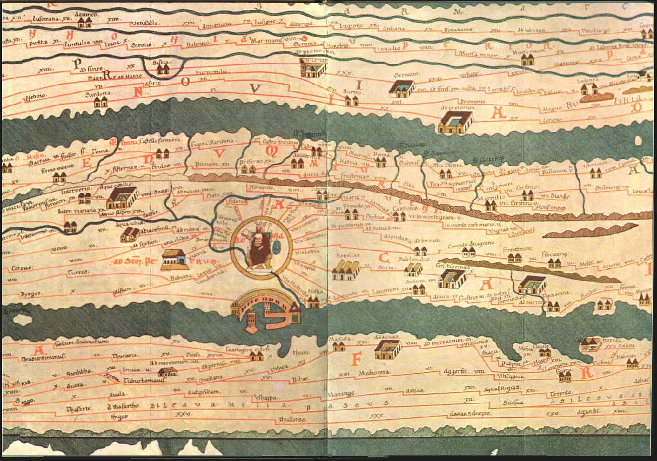

 .
.


Bookmarks